
Why the hill matters
The Lesser Garth is not an ordinary hillside, and understanding the history of what is inside it explains a great deal about 30 July.
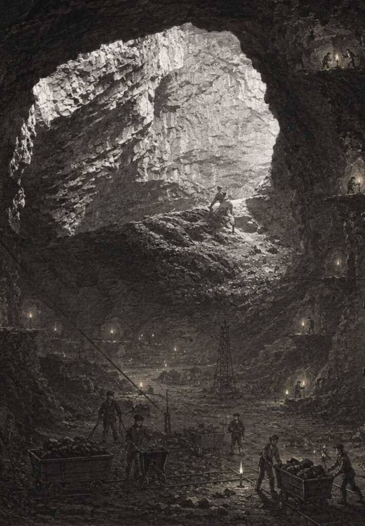
A worked hill
People have used this hill for a very long time. Archaeologists have found material here from the Bronze Age, the Romano-British period, the Early Medieval, Medieval and Post-Medieval periods.
Wales’ first ironworks were here, probably before 1570, and contemporary documents name the Lesser Garth as the source of the iron ore.
The Garth Iron Mine itself dates from the 1600s, although it was worked hardest in the nineteenth century. The Royal Commission on the Ancient and Historical Monuments of Wales records it as a haematite mine, worked through shafts and an adit, immediately adjacent to the Taffs Well dolomite quarries. Richard Blakemore began the modern workings in the early 1800s and his nephew Thomas William Booker carried them on. The Royal Commission records that the mine was officially abandoned in 1884.
What was left behind is not a single tunnel. It is a system of shafts, stopes, chambers and access routes, much of it now under water, together with the West Adit.
The scale of the workings
The Royal Commission’s record for the site describes a “giant cavern of ore”, and notes that Victorian and later visitors were given tours of the mine after it closed “on account of its vast scale, and the various colours of the water in the flooded chambers”.
A detailed account of the mine by Reg Malpass, written with acknowledgement to Pentyrch and District Local History Society, sets out what that scale meant in practice. Four main workings were opened at the surface and driven downwards following the ore. As they deepened, they were linked to one another underground by caverns and by shafts sunk between levels. One chamber is estimated in that account to have been roughly 200 feet long, 100 feet wide and 70 feet high, with no supports holding it up. By the time the mine was abandoned, the workings were around 400 feet deep, and the main pit was about 120 feet across at the surface.
The same account puts the quantity of ore removed over the life of the mine at around 700,000 tons, with some estimates as high as a million tons. Almost all of it was broken out and carried by hand.
It also records that the separate workings were connected to one another at intervals deliberately, so that air would move through the mine. The connections between different parts of this system are not accidental, and they are not recent.
The tunnel that drains the hill
In the 1840s a tunnel around 400 yards long was driven into the hillside from near the Pentyrch road to meet the main working chamber, roughly 200 feet below the top of the workings. The Royal Commission’s record dates this adit to 1840. The Malpass account records a stone recovered from its entrance carrying the date 30 June 1842.
It was driven for two reasons. It gave a shorter and easier route in and out for the ore. It also drained the mine at that depth, with a Cornish beam engine pumping water up to it from the workings below.
When the mine closed in 1884 the pumping stopped. The Royal Commission records that the mine “became flooded up to the tunnel level”, and that is broadly where the water has stood ever since. Planning documents seen by residents describe the West Adit as acting as the overflow point, or lip, of the flooded mine system. In plain terms, once water inside the old workings reaches the level of that tunnel, it can drain out through that route rather than rising higher inside the mountain.
The Malpass account records that the tunnel entrance was sealed with steel doors in January 2004. It also describes a second tunnel, started about 360 metres further east to reach the eastern chambers and never finished, which was left open and which carried the sound of running water.
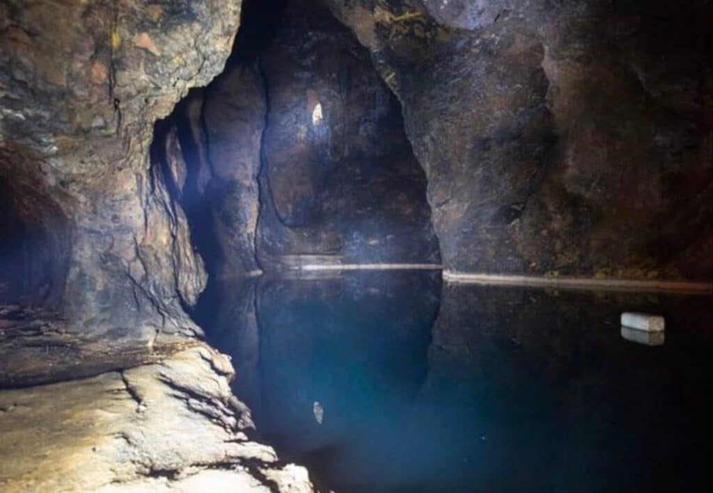
Water inside the hill
A publicly available 2018 inspection report on the Garth Mine suggests that the flooded workings may hold in the order of one million cubic metres of water. That is roughly four hundred Olympic swimming pools, held inside and behind the hill above the village.
When the Health and Safety Executive set out what it had established about 30 July, it described rock from a planned blast entering “one of four interconnected known bodies of water collected in the old iron mine workings”, and a substantial volume of that water being displaced out of an existing mine adit. The HSE has not said which workings it means, and we cannot match its four to the four described in the historical accounts. What both descriptions have in common is straightforward enough: this mine was dug as a connected system, the water in it sits behind and above the village, and it stands at the level of a tunnel driven in the 1840s.
The workings have been pumped dry before, and it was slow work. The Malpass account records that when a company reopened part of the mine to extract ochre in 1926, the lower workings stood under about 200 feet of water and took eighteen months to empty, using a pump floated on a raft. During the Second World War, when the upper chambers were used to store ammunition, debris cleared out of them was tipped into the flooded lower section.
A protected landscape
The hill also sits within a sensitive natural setting. It includes Garth Wood Site of Special Scientific Interest, part of the Cardiff Beech Woods Special Area of Conservation, ancient and mature broadleaved woodland, and rare woodland plants including the bird’s-nest orchid.
Lesser Garth Cave, which is separate from the iron mine, is an important limestone cave habitat and is recorded as one of only two known sites in the UK for a nationally rare cave-dwelling spider.
The wider mine, cave and woodland habitats may support other protected or notable wildlife, including bats, uncommon cave invertebrates and woodland birds. There are local reports of a little owl around the mine workings.
Why we set this out
Not to make the hill sound romantic. The point is a practical one.
Nothing on this page was hard to find. The scale of the workings, the way they connect to one another, the tunnel the water drains through and the condition of the mine are set out in the national historic environment record, in local history published decades ago, and in the planning documents for the quarry itself. All of it was on the record long before July.
That is what makes the questions on the next page reasonable ones to ask.
Where this information comes from
Little Garth Mine, Pentyrch, record NPRN 33954 in Coflein, the online database of the National Monuments Record of Wales, maintained by the Royal Commission on the Ancient and Historical Monuments of Wales.
An account of the Garth Iron Mine by Reg Malpass, published online in 2007 with acknowledgement to Pentyrch and District Local History Society. The Royal Commission drew on his work when it added to the national record for this site in 2009.
Pentyrch and District Local History Society has published on the hill and its ironworking over many years, including “IRON!” by J Barry Davies and John G Owen, June 2003, and “Secrets of the Lesser Garth” by Don Llewellyn, September 2005.
The Health and Safety Executive statement on the flooding, reported by BBC News on 5 August 2026.
If you think anything here is wrong, or you can add to it, please tell us. We will correct it.
The questions this raises
The significance of the hill was documented long before July. That is what makes our questions reasonable ones to ask.